Thank you for Subscribing to Construction Business Review Weekly Brief


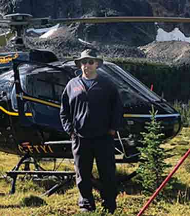 Iain Skinner, President
Skinner Geomatics has built its practice around serving fly-in communities and taking on complex, one-off surveying assignments that require substantial logistical planning, practical judgment and specialist field expertise.
Coordinating two or three projects during the same trip, it makes remote surveying more practical while reducing the travel burden associated with individual mobilizations. For communities without a permanent land surveyor, that coordination helps address cost and availability barriers while making professional surveying more accessible before boundary issues become disputes.
“We specialize in small communities and challenging assignments,” says Iain Skinner, president. “We like doing unusual, remote projects.”
Navigating Surveying Complexity with Experience and Precision
With more than 30 years in surveying, including experience as an Alberta land surveyor and Canada land surveyor, Skinner brings the experience to think through unusual assignments before crews reach the field. Those assignments have included boundary-panel work involving disputed boundaries, along with Indigenous land claim settlements, Alberta–British Columbia boundary restoration, mine work, wildfire recovery and flood mitigation.
Every assignment begins with understanding the client’s objectives and identifying the logistical requirements that will shape the work ahead. Regular communication keeps clients informed as scheduling, approvals and travel arrangements evolve throughout the project.
Client involvement varies by project type. Government projects generally begin with a defined scope, followed by bidding, contract negotiations and delivery of the required survey returns. For clients approaching the company directly, the process involves more guidance to determine what needs to be surveyed. Skinner works through the requirements with them, determines the necessary reports or digital files, gets the paperwork underway and stays involved through what can be months of approvals, carrying the project through to registration and the issuance of new titles.
-
We specialize in small communities and challenging assignments. We like doing unusual, remote projects.
Client involvement varies by project type. Government projects generally begin with a defined scope, followed by bidding, contract negotiations and delivery of the required survey returns. For clients approaching the company directly, the process involves more guidance to determine what needs to be surveyed. Skinner works through the requirements with them, determines the necessary reports or digital files, gets the paperwork underway and stays involved through what can be months of approvals, carrying the project through to registration and the issuance of new titles.
Advancing Innovation while Preserving Human Expertise
Technology may continue to evolve, but surveying still requires professionals who are prepared to spend long periods in the field and work through difficult conditions. Building that field-ready expertise will remain as important as adopting new tools.
Real-Time Kinematic (RTK) is used regularly in the field, particularly in northern areas where limited tree cover can make it especially useful. Drones support work on mine sites and long linear projects such as highway surveys, while photogrammetry can provide additional coverage across large areas. The company has also expanded into bathymetric surveying, using sonar-equipped equipment to survey larger rivers and lakes.
These tools support field operations, but they do not replace the professional judgment required to locate original survey evidence, interpret boundaries and establish or restore monuments on the ground.
The operating season also shapes how that expertise is applied. In northern communities, snow and shorter daylight can narrow the field window by early fall, making summer a concentrated period for completing projects before winter conditions arrive. Winter, in turn, provides time for reporting, safety training and equipment upgrades. For Skinner Geomatics, the value of specialized surveying lies in being prepared for assignments that demand more before, during and after fieldwork.
That combination of field expertise, logistical planning and specialist access continues to shape Skinner Geomatics’ role in the small communities and challenging environments where unusual surveying work demands more.
Planning Land Surveys beyond Easy Access
A survey assignment can stall before fieldwork begins when access depends on seasonal travel, local coordination, permit timing and transportation availability. In remote regions, mobilization may cost more than the survey itself. A missed flight window or incomplete scope can turn one site visit into another round of travel, while northern weather compresses the field season and limits daylight. Procurement decisions must therefore account for how a firm plans the work, not only how it measures land.
Scope definition deserves scrutiny. Government projects often arrive with formal deliverables, yet private landowners and smaller developers may know the result they want without understanding the legal steps required to reach it. Boundary work can involve historical evidence, damaged monuments, conflicting records and competing interpretations. Subdivision work may require months of approvals before a plan can be registered and new titles issued. A capable surveyor should clarify the intended legal outcome and required documentation before exposing approval dependencies that could affect mobilization.
“Skinner Geomatics’ planning model is built around light travel, coordinated northern mobilization and the longer approval cycles common in remote communities.”
Remote access changes the cost model. Sending a crew north for one assignment can be difficult to justify, particularly in communities without a resident land surveyor. Coordinating several jobs during one trip can spread travel expenses, but it also demands realistic scheduling and clear communication among unrelated clients. Buyers should examine whether a provider can plan around barge deliveries, fly-in access, wildfire disruption and short construction seasons without creating false certainty around dates.
Technical judgment matters most when the evidence is incomplete or the assignment falls outside repetitive urban work. Original monuments may be missing, and boundaries may be disputed. Rebuilding after fire or flood can also require an entire settlement pattern to be re-established. Technology helps, though it does not remove the need for field investigation. RTK equipment can speed positioning in open terrain, while drones and photogrammetry improve coverage across long corridors. Sonar and other bathymetric tools extend survey work into rivers and mine sites. The real test is whether each method fits the site rather than appearing in a standard equipment list.
Staffing should also be involved in the buying decision. Remote surveying still requires people willing to work outdoors, travel for extended periods and complete physical evidence searches under difficult conditions. Credentials establish legal authority, but experience determines how well a crew interprets unusual conditions and adjusts when regulators request changes. Buyers should look for licensing in the relevant jurisdiction and demonstrated boundary judgment. Field capacity and a safety process suited to isolated work deserve equal attention.
Skinner Geomatics is the premier choice for assignments where difficult access and unusual boundary conditions shape the work. Licensed in Alberta and on Canada Lands, it undertakes remote location surveys, subdivisions, boundary determination and monument restoration. Its planning model is built around light travel, coordinated northern mobilization and the longer approval cycles common in remote communities. Skinner Geomatics also applies RTK, drone photogrammetry, sonar and bathymetric equipment where site conditions warrant them. For buyers facing limited access, seasonal deadlines, uncertain boundary evidence or complex approvals, that combination supports a more practical survey plan before crews enter the field.
...Read more
